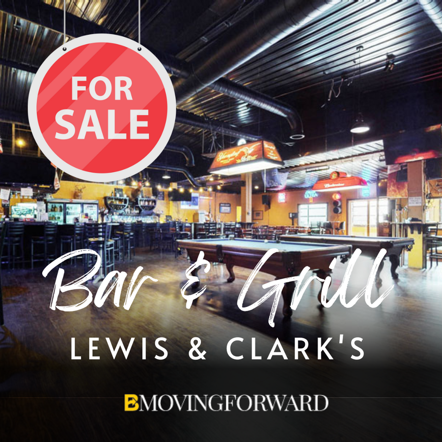
Property Record
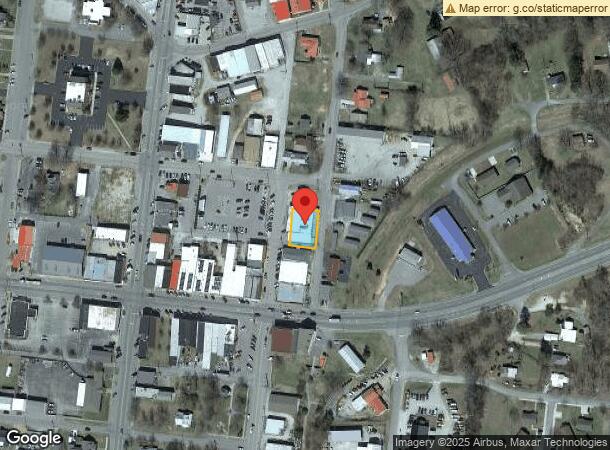
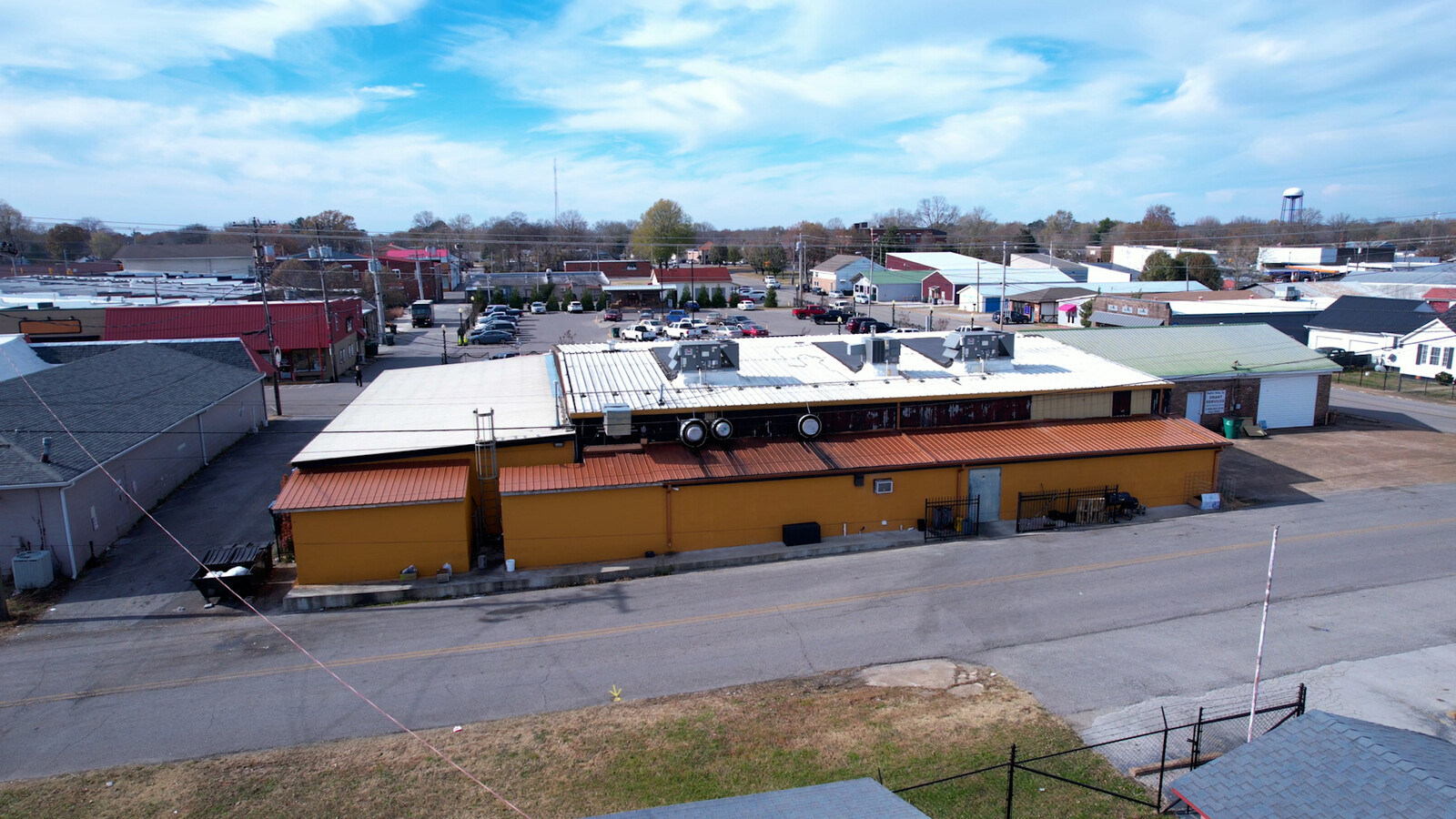
35 N Maple St, Hohenwald, TN 38462
NEARBY LISTINGS FOR SALE OR LEASE
Property Detail
35 N Maple St
Storebuilding
DISTRICT: 03 .20 OF AN ACRE, COUNTY AREA: H40
X
Lewis
47101C0125C
Tennessee
0
0.23 AC
2024
Tennessee Central Area
970200
Other Market Areas
6,892 SF
035P-B-008.00
DEMOGRAPHICS near 35 N Maple St
1 Mile
3 Mile
5 Mile
2024 Total Population
3,098
6,851
9,062
2029 Population
3,313
7,330
9,705
Pop Growth 2024-2029
+ 6.94%
+ 6.99%
+ 7.10%
Average Age
41
41
42
2024 Total Households
1,258
2,754
3,634
HH Growth 2024-2029
+ 6.92%
+ 6.97%
+ 7.04%
Median Household Inc
$34,080
$36,805
$38,067
Avg Household Size
2.40
2.40
2.40
2024 Avg HH Vehicles
2.00
2.00
2.00
Median Home Value
$110,121
$128,710
$137,162
Median Year Built
1979
1983
1984
Nearby Places
- Restaurants
- Banks
- Shops
- Fitness
- Groceries
SALE & LEASE HISTORY
LISTING DATE
SALE/LEASE

Mar 13, 2023
For Sale
Nearby Properties
Address
Land Use
TOTAL SIZE
Lot Size
Zoning
Address
Land Use
TOTAL SIZE
Lot Size
Zoning
100,314 SF
15.03 AC
C3
Address
Land Use
TOTAL SIZE
Lot Size
Zoning
49,242 SF
3.30 AC
C2
Address
Land Use
TOTAL SIZE
Lot Size
Zoning
12,999 SF
2.15 AC
C3
Address
Land Use
TOTAL SIZE
Lot Size
Zoning
38,086 SF
4.96 AC
C3
Address
Land Use
TOTAL SIZE
Lot Size
Zoning
7,498 SF
53.50 AC
R2
Address
Land Use
TOTAL SIZE
Lot Size
Zoning
56,237 SF
13 AC
M1
Address
Land Use
TOTAL SIZE
Lot Size
Zoning
1,944 SF
3.75 AC
L03
Address
Land Use
TOTAL SIZE
Lot Size
Zoning
8,915 SF
6.25 AC
R3
Address
Land Use
TOTAL SIZE
Lot Size
Zoning
9,680 SF
0.71 AC
C2
Address
Land Use
TOTAL SIZE
Lot Size
Zoning
11,290 SF
0.41 AC
C3
Address
Land Use
TOTAL SIZE
Lot Size
Zoning
6,116 SF
5 AC
L10
Address
Land Use
TOTAL SIZE
Lot Size
Zoning
10,064 SF
5.37 AC
C2
Address
Land Use
TOTAL SIZE
Lot Size
Zoning
1,368 SF
7.79 AC
C3
Address
Land Use
TOTAL SIZE
Lot Size
Zoning
26,190 SF
1.78 AC
C3
Address
Land Use
TOTAL SIZE
Lot Size
Zoning
35,000 SF
21.83 AC
M2
Address
Land Use
TOTAL SIZE
Lot Size
Zoning
69,120 SF
22.99 AC
M2
Address
Land Use
TOTAL SIZE
Lot Size
Zoning
33,645 SF
2.89 AC
C3
Address
Land Use
TOTAL SIZE
Lot Size
Zoning
4,836 SF
1.40 AC
C2
Address
Land Use
TOTAL SIZE
Lot Size
Zoning
6,467 SF
1.89 AC
C3
Address
Land Use
TOTAL SIZE
Lot Size
Zoning
1,019.60 AC
Address
Land Use
TOTAL SIZE
Lot Size
Zoning
5,240 SF
Address
Land Use
TOTAL SIZE
Lot Size
Zoning
6,657 SF
4.90 AC
C3
Address
Land Use
TOTAL SIZE
Lot Size
Zoning
7,441 SF
2.87 AC
C3
Address
Land Use
TOTAL SIZE
Lot Size
Zoning
5,240 SF
Address
Land Use
TOTAL SIZE
Lot Size
Zoning
344,957 SF
24.68 AC
M2
Address
Land Use
TOTAL SIZE
Lot Size
Zoning
10,389 SF
3.80 AC
C3
Address
Land Use
TOTAL SIZE
Lot Size
Zoning
5,200 SF
0.90 AC
L03
Address
Land Use
TOTAL SIZE
Lot Size
Zoning
6,660 SF
1.42 AC
C3
Address
Land Use
TOTAL SIZE
Lot Size
Zoning
19,312 SF
2.05 AC
C3
Address
Land Use
TOTAL SIZE
Lot Size
Zoning
3,208 SF
4 AC
R3
The World's #1 Commercial Real Estate Marketplace
Connect with us
© 2025 CoStar Group
The information above has been obtained from sources believed reliable. While we do not doubt its accuracy we have not verified it and make no guarantee, warranty or representation about it. It is your responsibility to independently confirm its accuracy and completeness. Any projections, opinions, assumptions, or estimates used are for example only and do not represent the current or future performance of the property. The value of this transaction to you depends on tax and other factors which should be evaluated by your tax, financial, and legal advisors. You and your advisors should conduct a careful, independent investigation of the property to determine to your satisfaction the suitability of the property for your needs.